Photogrammetry / Mapping

Precision Aerial Mapping for Urban Parks
Transform public spaces into highly accurate, data-rich maps with our advanced drone orthomosaic services. Whether you’re managing city parks, sports complexes, or municipal land, our high-resolution aerial maps provide unmatched clarity and insight for planning, maintenance, and development.
What is Orthomosaic Mapping?
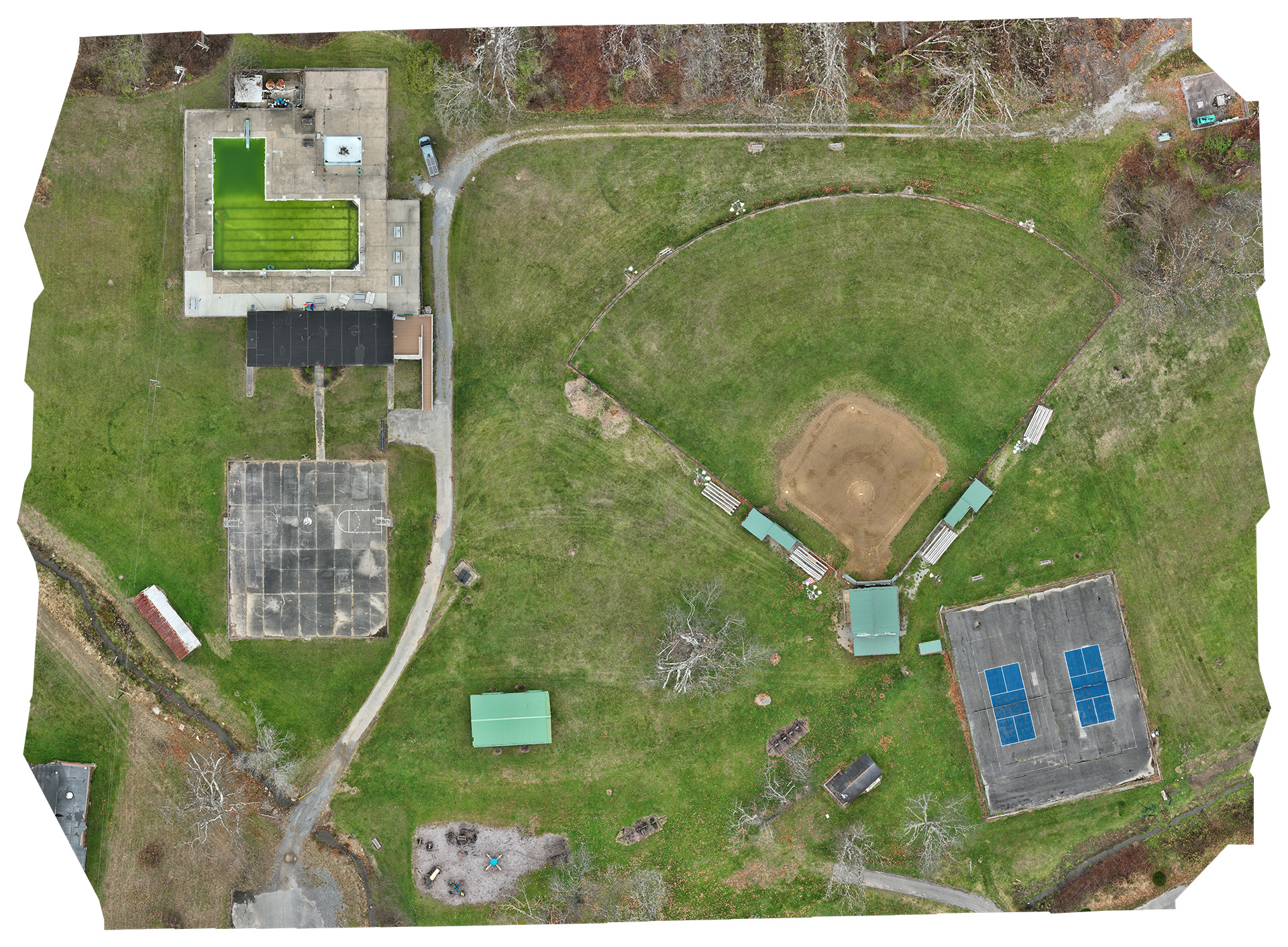
Orthomosaic mapping is the process of stitching together hundreds of high-resolution aerial images to create a detailed, georeferenced 2D map. Unlike traditional satellite imagery, orthomosaics offer centimeter-level accuracy, making them ideal for city planning, infrastructure assessment, and environmental monitoring.

Featured Project: Richwood City Park Mapping
Project Overview
The City of Richwood tasked us with creating an orthomosaic map of its City park, which includes a swimming pool, baseball diamond, and walking trails. The goal was to provide city planners and maintenance teams with a highly accurate, up-to-date map for infrastructure assessments, landscaping improvements, and future development projects.
Technical Execution
Using our RTK enabled drone, we conducted a carefully planned grid-based aerial survey to capture the park’s full extent. The flight plan ensured consistent image overlap, allowing for seamless orthomosaic generation.
Key steps in the process included:
- Automated Flight Planning – We designed a precise grid-based flight path to capture overlapping images for high accuracy.
- RTK Positioning for Survey-Grade Accuracy – The Mavic 3 Enterprise RTK module ensured precise geotagging of every image.
- High-Resolution Image Capture – The drone’s advanced camera system collected hundreds of 20MP images, covering every detail of the park’s features.
Overcoming Challenges
- Urban parks present unique challenges, such as water reflections from pools and inconsistent lighting across different surfaces. To mitigate these:
- Specialized Image Processing removed distortions from the pool’s water surface, ensuring accurate mapping.
- Shadow Correction Techniques minimized inconsistencies caused by varying light conditions across the baseball diamond and surrounding trees.
Results
The final deliverables provided city planners, maintenance crews, and environmental teams with an invaluable resource for monitoring and decision-making.
- High-Resolution Orthomosaic Map (GeoTIFF & KMZ) – A georeferenced aerial map with survey-grade accuracy.
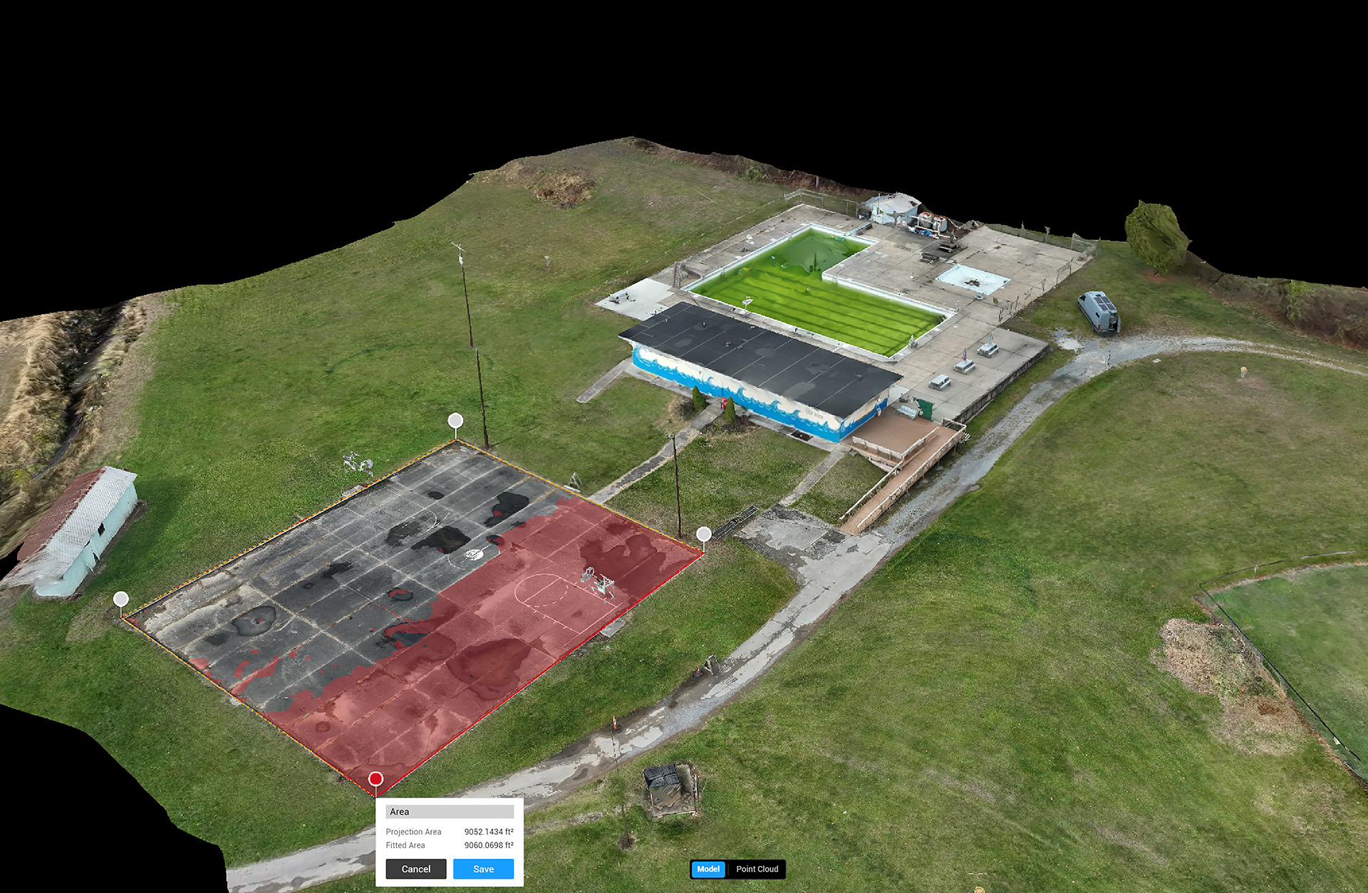
- Digital Surface Model (DSM) – A detailed elevation model for terrain analysis and flood assessment.
- Interactive Web-Based Viewer – A cloud-hosted version of the orthomosaic for easy access by city officials.
- Shapefiles for GIS Integration – Seamless import into ArcGIS or QGIS for infrastructure planning.
- This project showcases our expertise in urban mapping, demonstrating how drone-based orthomosaics provide superior accuracy and detail compared to traditional mapping methods.

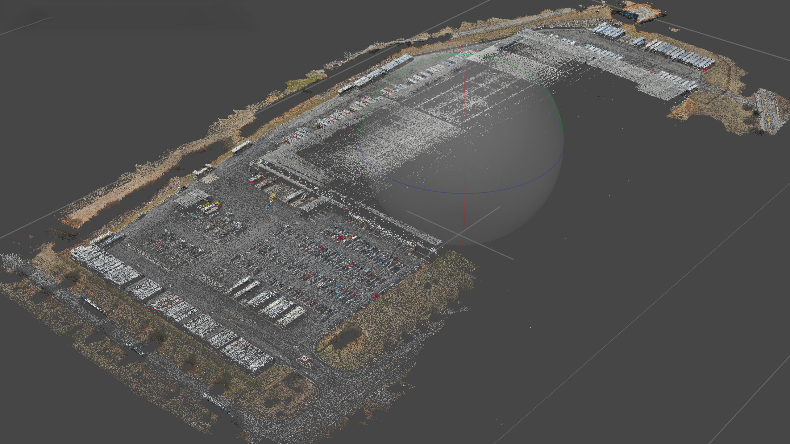
Above is a point cloud on its way to becoming an asphalt inspection report..
